Winners of the 2014 Geothermal Photo Contest Announced
The 35th Amateur Photo Contest winners will be on display at the GRC Annual Meeting in Portland, Oregon, USA.
(Portland, Oregon, USA) - The Geothermal Resources Council (GRC) is pleased to announce the winners of this year's Amateur Photo Contest. The purpose of the contest is to showcase quality photography featuring geothermal energy around the world.
All the entries can be seen on the GRC Flicker website at www.flickr.com/photos/geothermalresourcescouncil/ and will be showcased at the GRC Annual Meeting & GEA Geothermal Energy Expo being held at the Oregon Convention Center, Portland, Oregon, USA from September 28 –October 1.
The winners will be presented with prizes at the GRC Annual Member Meeting and Awards Luncheon, the climax to the GRC Annual Meeting. The theme for this year's meeting is Geothermal: a Global Solution.
For more information about the GRC Annual Meeting, visit www.geothermal.org or call (530) 758-2360.
###
About the Geothermal Resources Council:
With the experience and dedication of its diverse, international membership bolstering a more than 40-year track record, the Geothermal Resources Council has built a solid reputation as one of the world's preeminent geothermal associations. The GRC serves as a focal point for continuing professional development for its members through its outreach, information transfer and education services.
For more information, please visit www.geothermal.org.
Get your daily geothermal news at Global Geothermal News [globalgeothermalnews.com]. Become a fan on Facebook [www.facebook.com/GeothermalResourcesCouncil]. Follow GRC on Twitter [@GRCAM2014 & @GRC2001]. Check out GRC's YouTube Channel [www.youtube.com/GeothermalCouncil]. See geothermal photos on GRC's Flicker page. [www.flickr.com/photos/geothermalresourcescouncil]
###
Featured Product

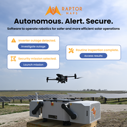
Raptor Maps - The integrated operating system for end-to-end solar management
Operate autonomous drones and other robotics technology on your solar farms with Raptor Maps' robotics operations platform. Our end-to-end solution allows you to build and schedule data collection missions, to analyze collected data through our analytics engine, and to address identified issues through our remediation intelligence suite. From construction monitoring to substation inspections to SCADA-alert generation missions, Raptor Robotics gives your team unparalleled insights into the health and status of your project. Improve the safety, efficiency, and scale of your operations with Raptor Robotics.
