3TIER Releases 5 km Wind Map of the World
Most accurate, consistent, comprehensive wind dataset available at the global scale
SEATTLE (Dec. 4, 2008) - 3TIER, one the largest independent providers of global renewable energy assessment and forecasting, today unveiled a 5 kilometer resolution global wind map based upon the most accurate, consistent and comprehensive dataset ever created of global wind resources and their spatial and temporal variability.
More Headlines
- Power Queen Unveils High-Performance 12V 140Ah Smart Lithium Battery for RVs, Off-Grid, and Home Energy Use
- Trina Storage Demonstrates High Efficiency and Long-Term Reliability in Verified Field Results
- SOLARBANK ISSUES UPDATE ON STRATEGIC POSITIONING AMID SHIFTING U.S. AND CANADIAN POLICY LANDSCAPE
- The Importance of UV Resistance to Solar Cable
- Sunshine Solar Power Selects the IONiX SmartWall for its Premium Energy Independence Solutions Portfolio

"This map is intended to accelerate the development of wind energy by quantifying the value of the wind resource at any location around the world," said Kenneth Westrick, CEO and founder of 3TIER. "The underlying dataset provides the information developers, financiers and governments need to target the best regions in the world for data collection and higher resolution studies. In short, this map and dataset shortens the process needed to make sound decisions about where to invest in wind energy generation."
3TIER unveiled its map and dataset at the 14th UN Climate Change Conference in Poznań, Poland, as part of the Global Wind Energy Council's (GWEC) "Wind Power Works" campaign. "Wind Power Works" is a focused, year-long effort to increase the understanding and visibility of the important role the wind energy industry and technology play in combating climate change.
To produce the 5 km wind map and the underlying dataset, 3TIER implemented an innovative physical-statistical modeling approach.
Unlike traditional models that merely interpolate observed wind speeds between widely dispersed points, 3TIER's system integrates statistical methods with the power of physical-based models, which simulate the interaction between the atmosphere and the earth's surface, to create a more robust and accurate wind climatology. That means the myriad processes responsible for wind - from jet level dynamics to surface level processes and everything in between - are accounted for in these models. They are able to create realistic wind fields throughout the world, with the results especially enlightening in regions where observations are not available.
3TIER ran its model through a 10-year simulation across the world's landmass at a 5 km resolution. The results then were calibrated and validated with observational data to create the final dataset and, ultimately, the world wind map.
"Our model produced more than a petabyte of data, which was combined with available observations to create the richest, most accurate and quantifiable dataset available at the global scale," Westrick said. "This project took nearly a year to complete, and the data shows we achieved our goal of finding the optimal blend between computer modeling technologies and observations."
The 5 km global wind map is a centerpiece of 3TIER's "REmapping the World'" initiative, a sophisticated mapping technology initiative launched last March to address the biggest barrier to global renewable energy adoption - the lack of information. At that time, 3TIER released a 15 km resolution global wind map based on a 1-year simulation.
3TIER also is mapping the world's solar resources. In October, 3TIER released the first comprehensive, contiguous, high-resolution solar map for the entire Western Hemisphere. The dataset 3TIER developed to create the solar map is approximately three times the resolution of existing industry solar data standards for the United States and is the only database today that covers all of North, Central and South America.
"To tackle the issues of dwindling fossil fuel supplies, growing energy demand, energy security, and climate change, an integrated approach to alternative energy is critical," Westrick said. "Through our REmapping the World initiative, we want to help change the way we look at the world's energy sources."
The 5 km global wind map will be available online in the first portion of 2009 through 3TIER's FirstLook Prospecting' tool at http://firstlook.3tiergroup.com/wind/. With one-click, the interactive map will provide annual average wind speed in meters per second, anywhere in the world, for free.
3TIER provides a full suite of assessment and forecasting services for wind, hydro and solar energy projects. 3TIER uses its knowledge about weather, climate and their impacts on weather-driven renewable energy resources to help customers make better decisions about their investments - before, during and after their projects are built.
To learn more about REmapping the World visit: www.remappingtheworld.com.
ABOUT 3TIER
Founded in 1999, Seattle-based 3TIER is one of the largest independent providers of wind, solar and hydro energy assessment and power forecasting worldwide. People around the world turn to 3TIER when they want the best scientific information to make decisions about renewable energy projects � from the prospecting stage to operations. For more information, visit 3tiergroup.com.
Featured Product
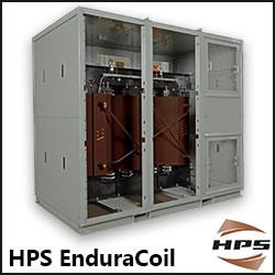
HPS EnduraCoilTM Cast Resin Medium Voltage Transformer
HPS EnduraCoil is a high-performance cast resin transformer designed for many demanding and diverse applications while minimizing both installation and maintenance costs. Coils are formed with mineral-filled epoxy, reinforced with fiberglass and cast to provide complete void-free resin impregnation throughout the entire insulation system. HPS EnduraCoil complies with the new NRCan 2019 and DOE 2016 efficiency regulations and is approved by both UL and CSA standards. It is also seismic qualified per IBC 2012/ASCE 7-10/CBC 2013. Cast resin transformers are self-extinguishing in the unlikely event of fire, environmentally friendly and offer greater resistance to short circuits. HPS also offers wide range of accessories for transformer protection and monitoring requirements.